On Thursday (18th Feb), Håkan Olsson, Professor in Remote sensing at SLU in Umeå, will give a seminar about remote sensing from 1930 until today. It is scheduled to 14:30 in Ljungbergslaboratoriet (1st floor in the SLU building).
On Thursday (18th Feb), Håkan Olsson, Professor in Remote sensing at SLU in Umeå, will give a seminar about remote sensing from 1930 until today. It is scheduled to 14:30 in Ljungbergslaboratoriet (1st floor in the SLU building).
This weeks seminar will be given by Inka Bohlin and Mats Nilsson. The title is: “Use of photogrammetric point cloud data together with field data from National Forest Inventory: possibilities and weaknesses”. Welcome to Ljungbergslaboratoriet on Thursday the 4th February at 14:30. The seminar is approximately 30 minutes including questions.
Anna Bylund from SCA forest will give a seminar on Thursday about the use and potential use of remote sensing data at SCA forest. The seminar will be given in Ljungbergslaboratoriet on Thursday the 28th January at 14:30.
Information about previous and upcoming seminars can be found here.
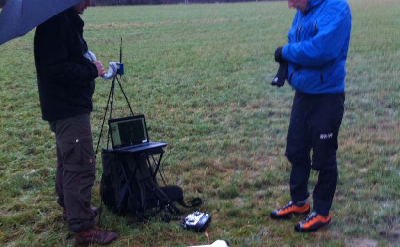
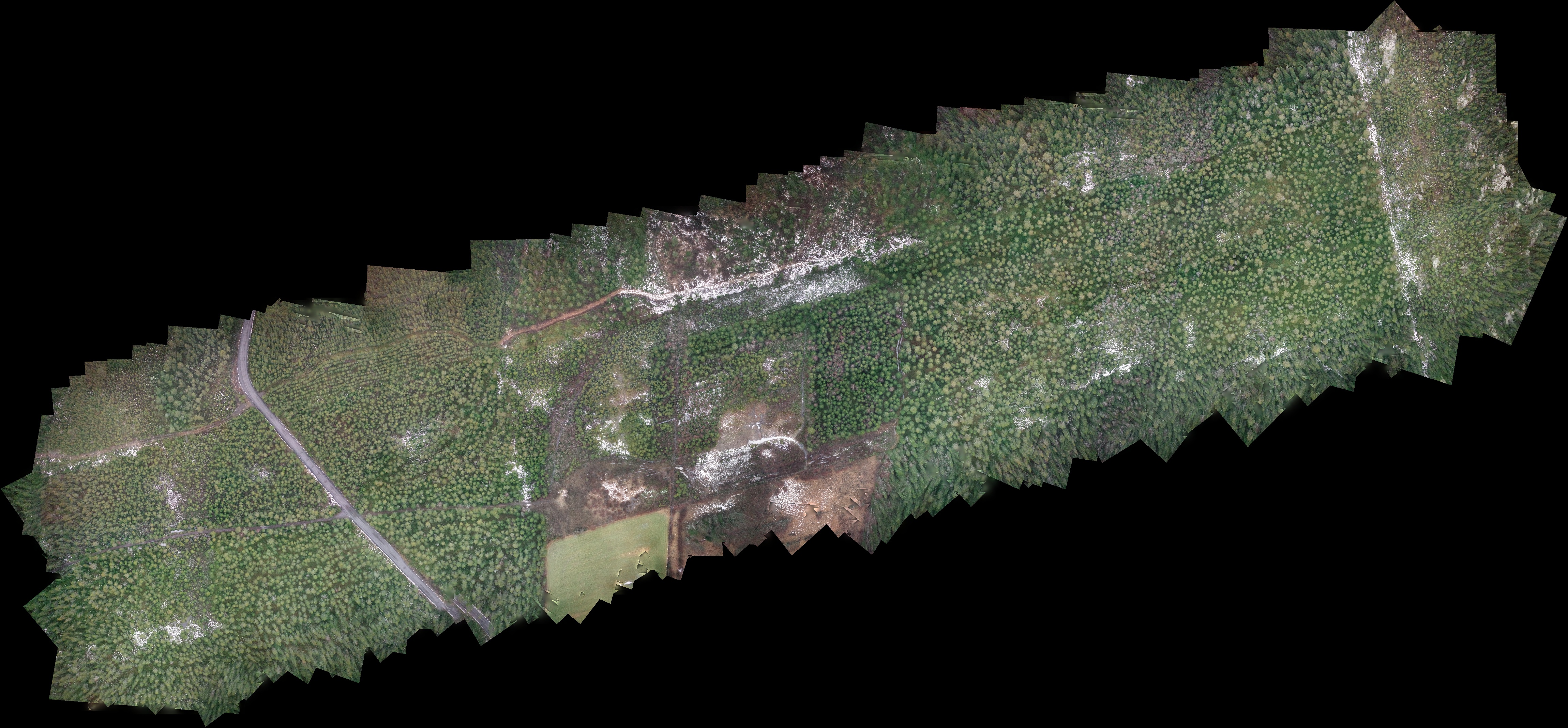
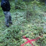
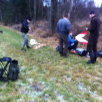
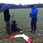
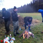
Today, the teachers and students of the Ljungberg lab, went to SLU’s new forest estate in Innertavle, close to Umeå. This forest is going to be used for teaching and research purposes. Our aim was to map it with a drone to get a high resolution orthophoto map and 3D data before the winter comes.
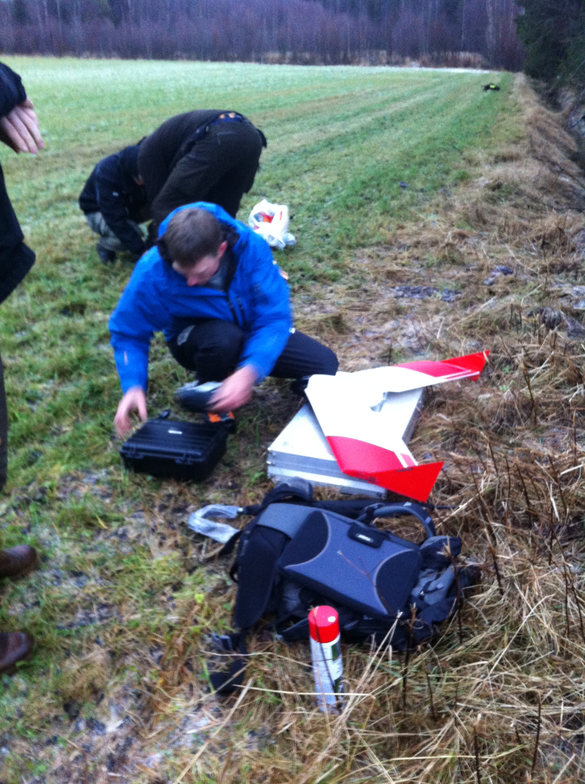
Mattias is fixing with the drone to get us in the air (in the background students making fire).
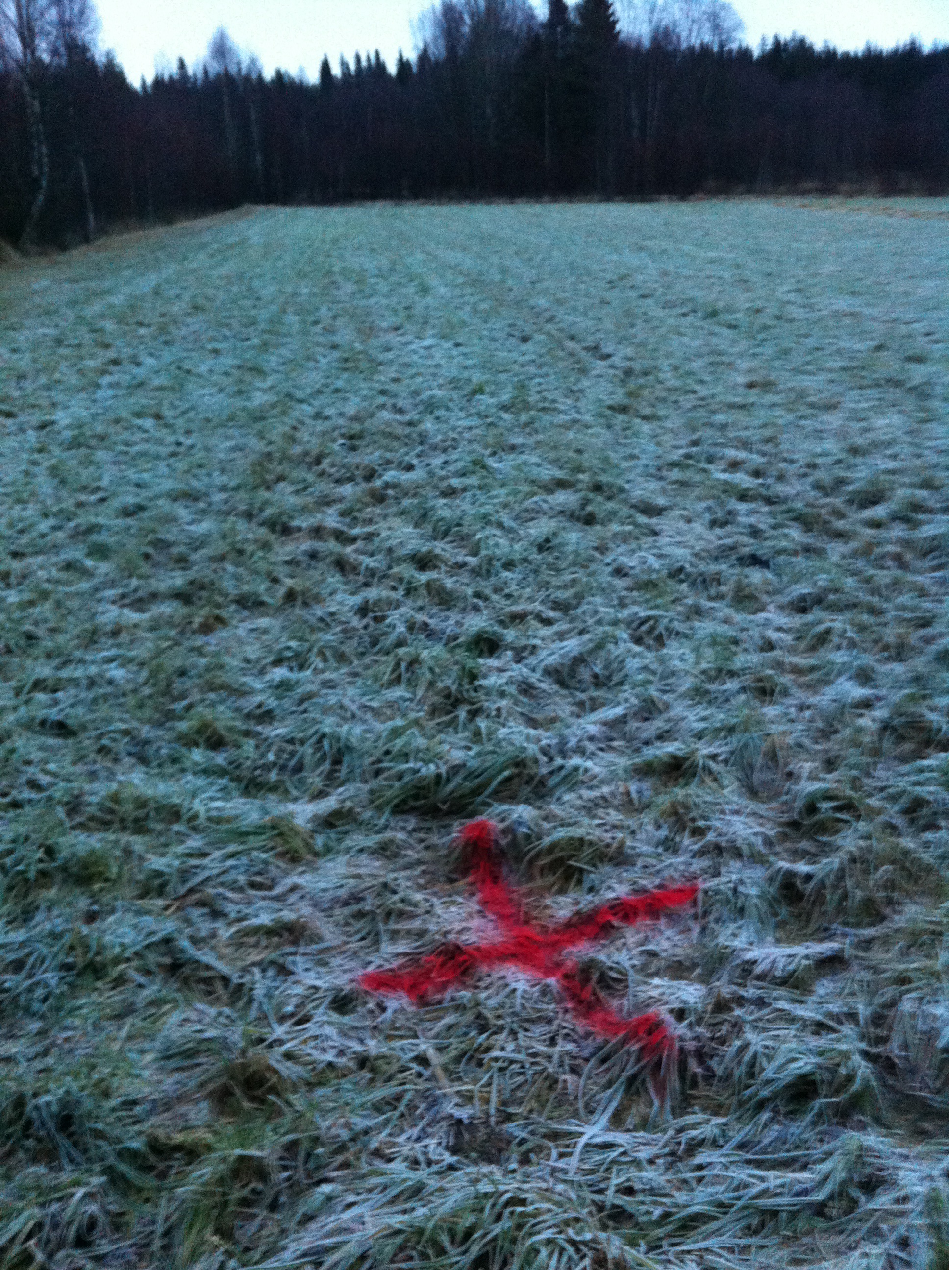
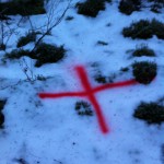
We sprayed red crosses, which are used for ground control points (GCP) to reference the images into the national coordinate system. These where to be positioned after the drone flight using a survey grade RTK-GNSS.
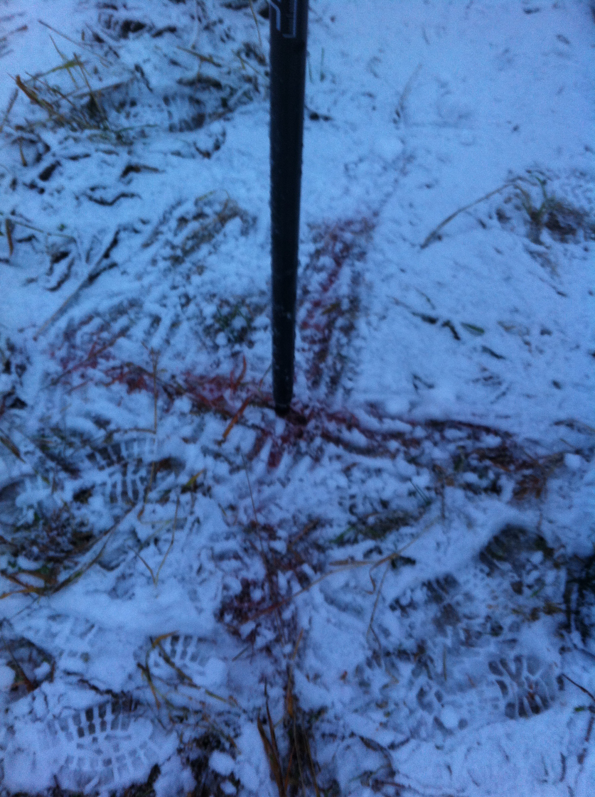
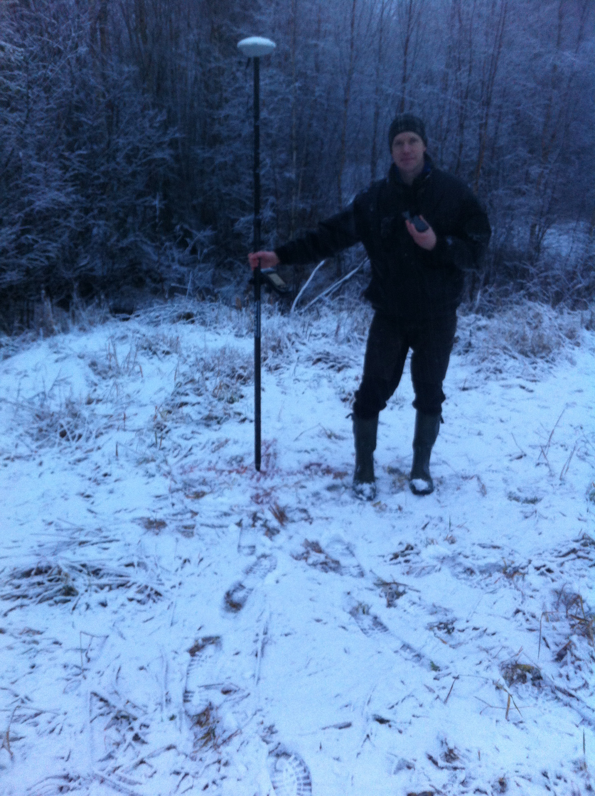
Unfortunately the winter came during the drone flight! Making it a very hard job to find the GCPs both when trying to position them and in the images when doing the image processing.
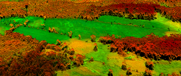
But we got some result! Here is a low resolution (GSD 29 cm) orthophoto of the eastern half of the estate (click image for full size). The final products will have better geometry and resolution.
Thanks to the students who brought BBQ lunch for us all!
/Jonas Bohlin
Gallery:
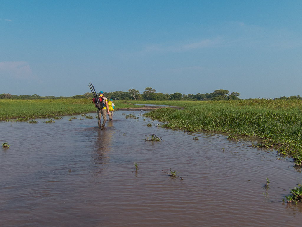
This weeks seminar will be given by Mattias Nyström who biked, kayaked and treked in Pantanal, the world’s largest flooded area, for one week. He will show maps and photos from his 700 km journey in this regions of Brazil.
This week we will give two seminars. The first on Tuesday 27 Oct about the regulations for drones in Sweden and the second on Thursday where Jonas Jonzén will present “A nationwide forest attribute map of Sweden derived using airborne laser scanning data and field data from the national forest inventory”. See seminars page for coming weeks seminars.
Tomorrows seminar (Oct 22) will be given by Johan Holmgren. He will present his contribution to the Silvilaser conference: “Estimation of tree stem attributes using ground based and airborne laser scanning”. You can also find the slides from the previous seminars on the Seminar page.
Next weeks seminar (Oct 29) will be given by Jonas Jonzén. He will present the nationwide forest attribute map of Sweden derived using airborne laser scanning data and field data from the national forest inventory.
Tomorrow morning, Friday Oct 8, Mattias will give a presentation about large scale laser scanning at the breakfast meeting at Sliperiet, Umeå. More specifically, Mattias will show airborne laser scanning (ALS) and terresterial laser scanning (TLS) and how this information can be used for forestry. More information about GE Garage in Umeå can be found here and also the registration for the event:
http://www.gegarages.com/global-tour/umea-garage/
Here is short summary about the event:
Scanning technology is an important tool in the digital borderland. Development in scanning technology is fast moving. The different application areas are numerous – the technology can facilitate the design process, re-engineering and verification. In addition there are, for example, applications to collect data in order to create digital archives.
Within this seminar we will take a closer look at scanning and try to give you an overview, from precision scanning on small objects to big area scanning. There will also be examples on how to use scan data as a base for further calculations.
Listen and take note of what is possible today and what will be possible in the future.
Speakers:
Friday, October 9
07:30 – 09:15 (including breakfast)
Location: Sliperiet/Coffee Space
Language: English
Daniel Bertilsson kommer att hålla sitt försöksplanseminarium på onsdag den 7:e oktober, kl 10.00 i rummet Årsringen. Dessa seminarium brukar ta mellan 30-45 minuter totalt. Daniel gör sitt examensarbete i Ljungbergslaboratoriet med titeln “Estimating forest density using TanDEM-X InSAR Data”. Huvudhandledare är Heather Reese, biträdande handledare är Henrik Persson, och examinator är Mats Nilsson.
On October 8, 14:30, the first seminar will be held in Ljungbergslaboratoriet. We’re sorry to announce that the seminar that should be given by Jonas Jonzén is postponed, but Mattias Nyström will instead give a presentation about “Data assimilation in forestry using laser data from 2003-2011”. All students are welcome and if there is room, others are welcome too.
Every Thursday during the autumn, Ljungbergslaboratoriet will host a seminar. The seminars will cover research topics in remote sensing and/or short introductions to tools used in remote sensing, for example lasTools and FME. The seminars are aimed for the students, but others are welcome if there is room.
Ljungbergslaboratoriet is located on the first floor with windows facing Campus. Contact: Mattias Nyström, phone +46 90 7868316