Skip to content
Ljungbergslaboratoriet

Ljungbergslaboratoriet

Remote Sensing laboratory

  • News
  • Workshops
  • Student projects
    • Bachelor thesis
    • Master thesis
    • PhD thesis
    • Design Build Test
    • Project work
  • Equipment
  • Software
  • Literature
  • Instructions / tutorials
    • Agisoft Photoscan pro
    • Parrot Sequoia on 3DR Solo
    • Pixhawk autopilot
    • Terrestrial laser scanning
    • Trimble GeoXR 6000
    • Topcon GRS-1
  • Seminars
  • Data
  • Media
  • Code examples
  • Virtual Reality
    • PointCloud XR
  • About Ljungbergslaboratoriet

Social media

  • View RemoteSensingSLU’s profile on Facebook
  • View UCIjkxj8mZXD-RuIiBY1Ta0Q’s profile on YouTube

Contact

ljungbergslaboratoriet@slu.se

Jonas Bohlin, SLU, Umeå

Data

  • Terrestrial laser scanning

    Terrestrial laser scanning

  • Remningstorp drone flights 2016

    Remningstorp drone flights 2016

  • Drone images, view on your screen

    Drone images, view on your screen


Parrot Sequoia first flights

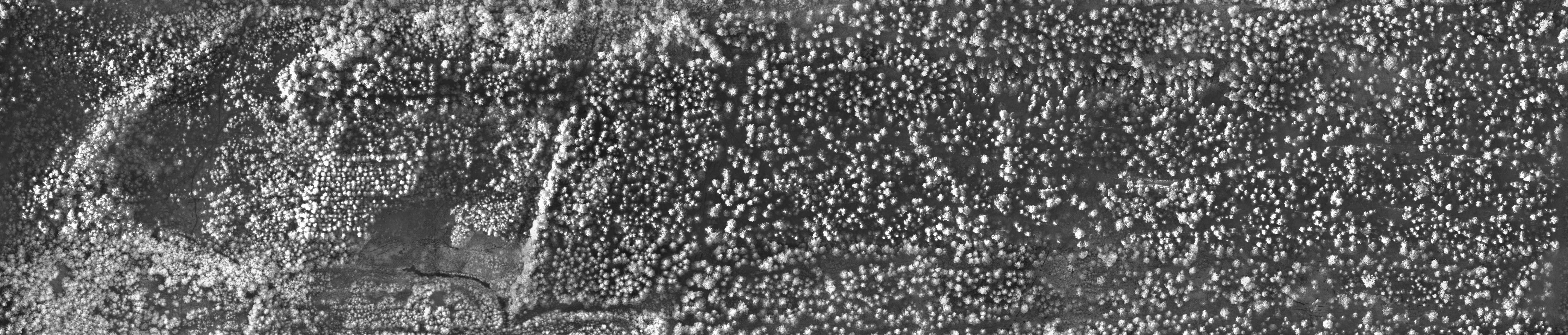
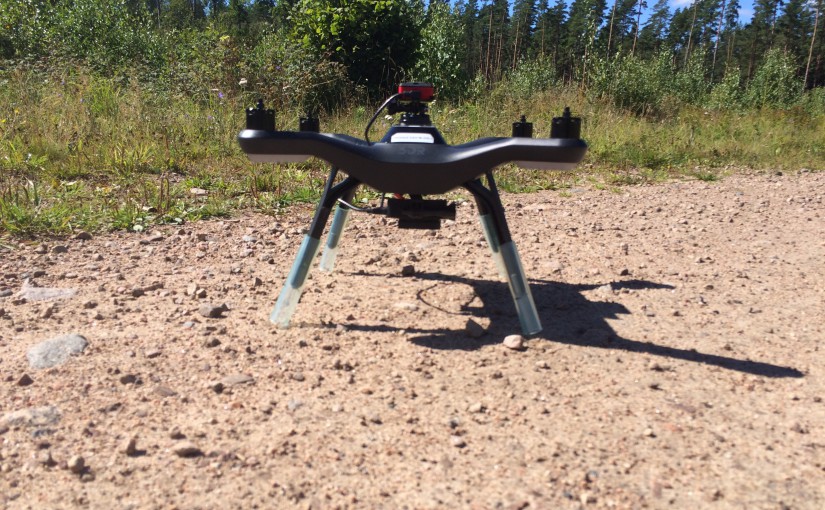
Two weeks ago, we did several flights with the lab’s new Parrot Sequoia multispectral camera. We have summarized how the camera can be mounted on a 3DR Solo drone. We also did a first quick 3D point cloud from the NIR photos:

The ortofoto in NIR-band looks like this:

innertavle_NIR

Share this:

  • Twitter
  • Google
  • LinkedIn
  • Facebook
Posted on August 30, 2016Author MattiasCategories News

Post navigation

Previous Previous post: Parrot Sequoia arrived!
Next Next post: Terrestrial laserscanning in virtual reality
Proudly powered by WordPress