Skip to content
Ljungbergslaboratoriet
Remote Sensing laboratory
Menu and widgets
News
Workshops
Student projects
Bachelor thesis
Master thesis
PhD thesis
Design Build Test
Project work
Equipment
Software
Literature
Instructions / tutorials
Agisoft Photoscan pro
Parrot Sequoia on 3DR Solo
Pixhawk autopilot
Terrestrial laser scanning
Trimble GeoXR 6000
Topcon GRS-1
Seminars
Data
Media
Code examples
Virtual Reality
PointCloud XR
About Ljungbergslaboratoriet
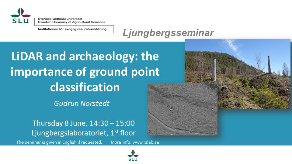
Seminar: LiDAR and archaeology: the importance of ground point classification
Post navigation
Previous
Previous post:
Master thesis presentation: Control Assessment Using Drones
Next
Next post:
SLU at ELMIA WOOD