
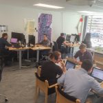
The lab has the following equipment:
- DJI Phantom 4 RTKA guide for using the Phantom 4 RTK out in the field. Weather condition The most important thing when planing to preform a field survey with a drone is the weather. If it is raining the drone should not go up … Continue reading DJI Phantom 4 RTK
- Mobile laser scanning backpack
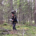 The lab has since 2015 developed a mobile laser scanning backpack to be used in the forest. The work is a cooperation between researchers and students.
 - Virtual Reality
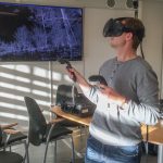 The lab has a HTC Vive Virtual Reality equipment. It is used to visualize point clouds from our scanners and drones.
 - Cameras
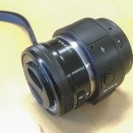 We have several different cameras that can be used either from air (drone) or from the ground.
 - Tools for service
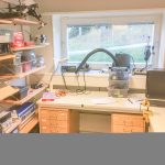 There is a separate room with work bench and tools for service of the lab’s equipment.
 - 75″ TV for presentations
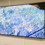 The lab has a 75″ UHD 4k TV for presentations.
 - Software
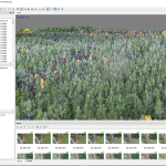 The lab also offers several softwares for analysis of the 3D-data.
 - Thermal camera
 The lab has a Flir Vue Pro 13mm thermal camera with 640×480 pixels resolution and 30 frames per second.
 - GNSS receivers
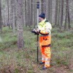 The lab have two high resolution GNSS receivers. The newest is a Trimble GeoXR 6000 from 2014 and the second is a TopCon GRS-1 from 2010.
 - Computers
 In the lab we have in total 7 computers specially designed to work with heavy processing of 3D-data.
 - Terrestrial laser scanner
 The lab has a Trimble TX8 laser scanner (from 2014). The scanner is used to collect accurate measurements of the ground and the tree stems. The scanner collects 1 million points per second and in three minutes a full hemispherical view is created with a point spacing of 4 mm at 10 meters distance.
 - Drones
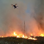
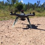
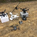 The lab has several drones designed for different loads and purposes, from small compact drones up to a 5kg hexacopter which can carry a payload of 2 kg.
 - Parrot Sequoia
 Parrot Sequoia is a small and light weight multispectral camera made for drones.